Hike Review

Hike Review: Fish Creek Falls, Steamboat Springs, CO

We recently took a long weekend camping trip to Steamboat Springs, Colorado to celebrate my husband’s birthday. He has lived in Colorado his entire life but had never been to Steamboat so it was awesome to celebrate him while exploring somewhere he had never been before.

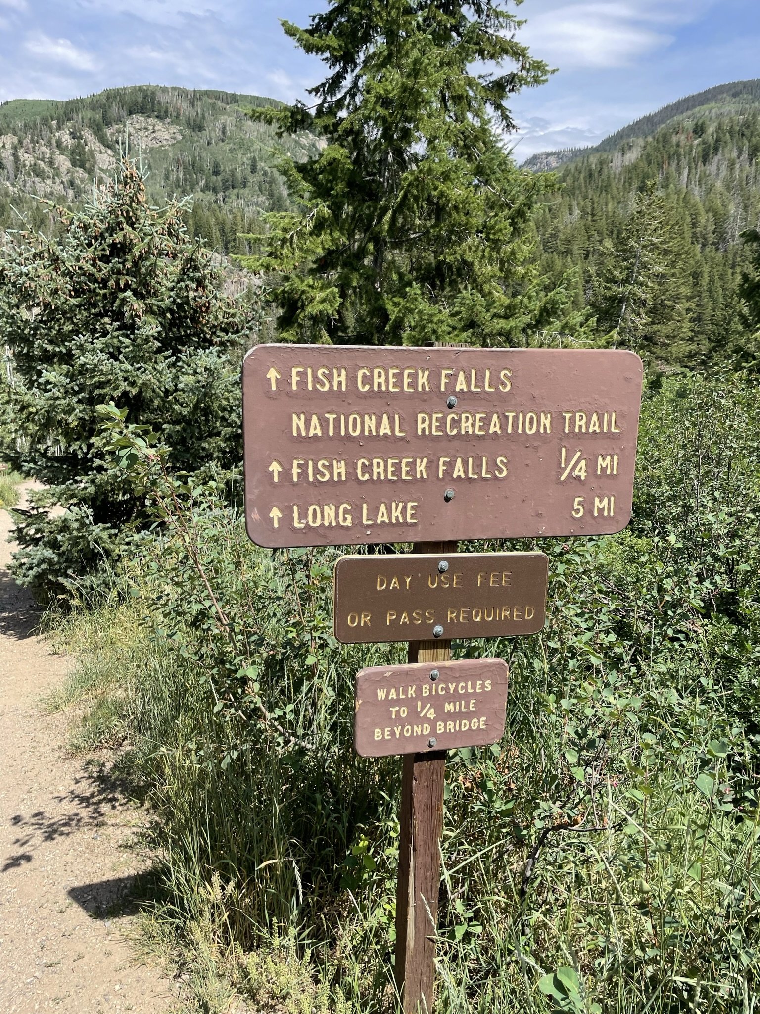
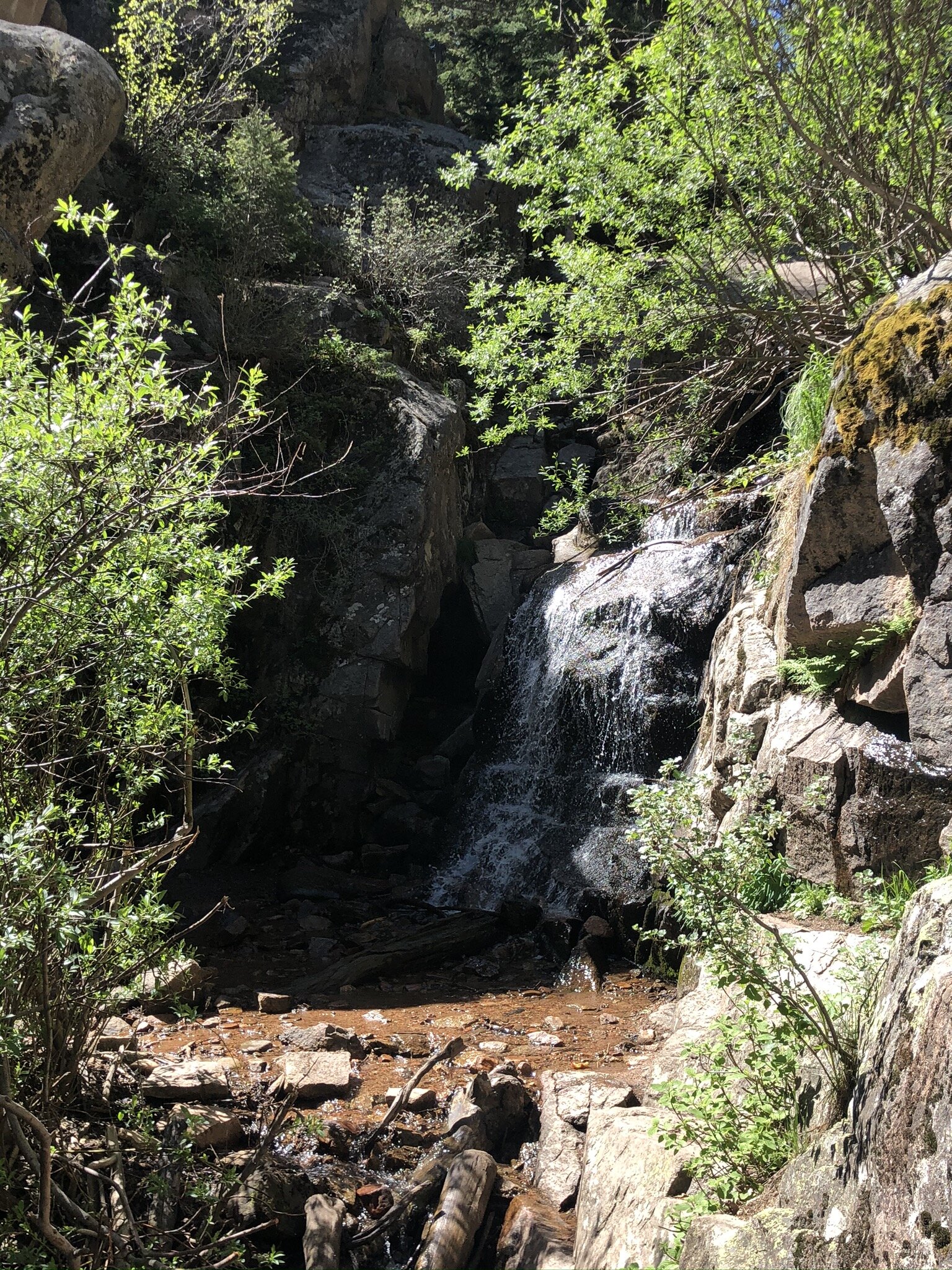
While we were camping, we decided to check out Fish Creek Falls - a well known hike and waterfall in Steamboat. There are small posted signs everywhere in town as to where the Falls are located vs where you you are standing and what direction you need to travel to get to them. Seeing all these signs made us feel like we had to check them out. And they did not disappoint!

Parking

There is a $5 fee to enter the parking lot. We were told if we had an America the Beautiful pass that the parking fee would be waved.

There are limited parking spots so on busy weekends they could fill up rather quickly.

Vault toilets were also in the parking lot, which is nice to see!

The hike

Awesome thing about this hike - there is a short hike and a long hike. Each of which are fantastic depending on what your overall desire and conditioning are.

The Short Hike - Fish Creek Falls

This hike is roughly a half-mile (0.5 mile) round trip. You start the hike going downhill and lose a lot of elevation very quickly. This is key to note as that means that your way out is going to be a pretty steep uphill hike.

You’ll know it when you get to the end of the short hike - you’ll have the most stunning view of the Falls.

The Long Hike - Long Lake

We didn’t make it all the way on the long hike. To be honest, we didn’t come prepared to go more than a few miles - I was in denim shorts and didn’t bring my hiker bag, just a small sling back that had more things in it for our doggo than it did for me. Definitely not enough water to make it on the longer hike.

But the section we did of it was beautiful and a steep grind.

You start out on the Short Hike and then proceed past the bridge and up you go, up the side of the mountain.

Apparently when you get to the top, you have an eye level view of the Falls that is supposed to be stunning. We will definitely be doing this the next time we are in Steamboat!

fish creek falls; steamboat springs; colorado; hikes; mountain hikes
waterfall; hiking; colorado waterfalls; fish creek falls; steamboat springs

Extra fun to be had

We hit the trail to the Falls on one of the hottest days of the year, so it should not have come to as big of a surprise as it did to find a ton of families at the river with their kids in swimming suits playing in the water.

The water was nice and cool - perfect for a scorching hot day in the mountains! We let Max, or doggo, play in the water for a while when we were on our way back to our car. He loved it!

fish creek falls; yellow lab; colorado mountain dog; river dog

Final thoughts

This hike is fantastic. I loved the option to do just the shorter hike to the viewing point as we didn’t come totally prepared for a longer hike. I also love that we could have continued on if we had come prepared to do so.

The fact that playing in the water was such a common thing made me smile and I know Max had the best time romping around in it.

It is an absolute must-do when you are in the Steamboat area.

fish creek falls; selfie; hiking; colorado hikes; waterfall hike; waterfall views
fish creek falls; fish creek; steamboat springs; steamboat colorado

Hike Review: Lily Pad Lake, Summit County, CO

Lily Pad Lake Trail is a fairly easy out and back trail nested at the top of Wildernest in Summit County that gives you great views of Lake Dillon and the mountain towns surrounding the lake.
Parking

There are limited designated parking spots. If you park in a non-designated parking spot, you will probably end up getting a parking ticket as the area is frequently patrolled by the Summit County Sheriff.

The Trail

The first time I did this trail, we snowshoed to the lake and back and it was amazing. But, I must say, going in summer is a totally different experience and one that I highly recommend as you learn very quickly why it is called Lily Pad Lake. In winter, the lake is frozen over and buried under feet of snow. In summer, it’s just gorgeous.

lily pad lake; colorado lakes; colorado wilderness; wildernest national forest; hiking

The hike itself can be done in about an hour and a half, but I would absolutely budget in some time to just chill at the lake. It was so calm and peaceful.

As you hike, you’re going to come across a mini lake that we thought was the Lily Pad Lake because it was absolutely covered in Lily Pads. But if you continue on, you’ll end up at the larger lake - the true Lily Pad Lake.

lily pad; lake; colorado lakes; hikes; lake hike; lake view

Smaller lake that is covered in Lily Pads! Continue on the trail to get to the actual Lily Pad lake.

Why We Loved This Hike

It’s short - only about 3 1/2 miles round trip. It’s beautiful. And dogs are allowed, on leash. We love taking Max out with us when we go hiking, but certain places do not allow dogs, so it’s an added benefit that he was able to join us.

Final Review

4 out of 5! I wish there were a few more parking spots at the trail head and that it was a tad bit longer. But it is a very solid and fun hike that ends with stunning mountain views at the lakes edge.

Eagles Nest Wildernest; National Forest; Hiking; Colorado; Summit County
trail, hiking trail, lily pad lake trail, colorado hikes, mountain views
lily pad lake; hiking; colorado hikes, hiker dog; yellow lab

Hike Review: Cheesman Canyon, Sedalia, CO

Cheesman Canyon is one of those hikes that has been on our list but not a high priority to do, thinking it wouldn’t be anything overly amazing. Well, we finally can cross this one off and, wow were we wrong! This hike has so much about it that we loved. In fact, the only thing we would say is a downfall is that there is very little shade. But, we did pick one of the hottest weekends of the summer to do this hike, so really that is our own fault, as this hike would be absolutely perfect on a warm but not blazing hot day.

Keep reading for our full review as to why we loved it!

IMG_1753.JPEG
IMG_1761.JPEG
  1. The hike is along a river!

    Yes, you literally hike along the river for the majority of the hike! There are a ton of fishermen around and a lot of access points from the upper trail to the water. So if you get too hot, you can work your way down to the water to cool off.

  2. Good ups and downs the whole way.

    We love a good hike that is pretty equal effort both ways. This is not a hike that is up one way and down the way back. You get the challenges of inclines and declines both ways. This means that you don’t have a ton of overall elevation gain (you never get above treeline) but you get the workout associated with a strong elevation gain!

  3. If you go far enough, you hit a reservoir.

    We did not make it far enough in on this hike to hit the reservoir (hello, 100 degrees by 10am!) but if we were to have kept going, there would have been a reservoir for us to sit by and enjoy. The reservoir feeds the river that you hike along. Needless to say, we will be back to get to the reservoir on a cooler day!

  4. Not overly busy.

    We arrived at the parking lot by about 8am and had no issues parking. However, when we were leaving there were cars circling the lot waiting for a space. There is no street parking - if you park on the street you will get ticketed if caught.

We will warn you that the trail is mostly loose gravel - meaning that the declines are slippery and your feet can definitely come out from underneath you if you aren’t overly cautious. Yes, speaking from experience on that one. Whoops! Luckily I only scraped my hand a little bit, but it could have been much worse!

Overall, we give this hike a 4 out of 5 stars.

Happy Trails!
Liz

IMG_1751.JPEG
IMG_1768.JPEG
IMG_1788.JPEG
IMG_1802.JPEG
Hike Review Cheesman Canyon.jpg

Hike Review: Tyndall Glacier and Nymph, Dream, Emerald, and Haiyaha Lakes, Rocky Mountain National Park, CO

Disclaimer: this is an opinion about our personal experience of this hike. Others may have a different opinion, and that is perfectly acceptable. Everyone has a right to their own opinion.

This particular hike we come back to time and again because of how beautiful the scenery is. Located in Rocky Mountain National Park, this hike features so many amazing things, you can’t help but just be in awe the entire hike. 4 lakes. A couple waterfalls. A glacier. It’s one of our all time favorites and we hope you enjoy it as well if you choose to hike it!

IMG_1343.jpg

Getting into RMNP

This year, you must reserve a time slot entry to get into RMNP, as well as have a pass to get into the park for the day. The pass can be a season pass, a day pass, the American the Beautiful Pass, etc. This has changed from prior years due to the Covid-19 outbreak. They do not offer these time slot entries at the gate so you much reserve them online in advance. To do that, you can CLICK HERE or log into recreation.gov, search for Rocky Mountain National Park, pick a date that has available time slots and pick your time! Once you pick your time, you have two hours to enter the park, so if you purchase the 8am entry, you have from 8am - 10am to enter the park. Once you are in the park, you can stay as long as you want. Be sure to take a screenshot of your confirmation on your phone, or print it out, as you will have to show it at the gate.

IMG_1202.jpg

Where to park

Parking is all over the park once you get in, but watch for the road signs on what is full. If you can, we recommend parking at Bear Lake Lot - it’s the closest parking lot to the trail head. We say “if you can” because this lot fills up FAST. If it’s full, we recommend the park-and-ride lot. It’s easiest to find parking and you will have quick access to a shuttle bus that will take you up to Bear Lake and will have access to the same shuttles to take you back to your car when you are ready to head out.

The Elevation

This hike is a 5.1 mile out and back hike that has an elevation gain of ~1,100 feet. Keep in mind that you are starting at a very high elevation already at 9,449 ft above sea level. Entering the park, you will be at 7,860, and you will gain substantial elevation driving up to Bear Lake. Bring more water than you think you’ll need, snacks, and something with salt - your body might need it.

If you are coming from out of state, be sure to read about elevation sickness and the warning signs - it’s a very real thing and it’s not fun if you have it.

The Hike Itself

This hike is STUNNING. There are four lakes - five if you count Bear Lake - and they are so gorgeous. Our favorite one… it’s hard to pick! But if I had to, the lake at the base of the glacier is unreal and totally makes the hike. Be sure to look into the water as you walk by as you can some time see some fish swimming along.

DSCN0336.JPG

We went in mid-June and there were still patches of snow on the hike. We did not have to use any gear other than our hiking boots, and saw some people in regular tennis shoes cross through the snow patches with no issues.

Rocky Mountain National Park is stunning and this hike showcases it to the nth degree. We absolutely love it and tend to hike this at least once a year. We give this hike a rare 5 out of 5 stars. Let us know what you think when you hike this as well!

Additional Resources You Might Enjoy:

Hike Review: Eagle’s View Trail

Day Trip Hiking Pack List

DSCN0354.JPG
DSCN0379.JPG
IMG_1390.JPEG
IMG_1431.JPEG
Hike Review_ Tyndall Glacier, Nymph, Dream, Emerald Lakes.jpg

Hike Review: Eagle's View Trail Loop, Conifer, CO

Disclaimer: this is an opinion about our personal experience of this hike. Others may have a different opinion, and that is perfectly acceptable. Everyone has a right to their own opinion.

We’ve absolutely been loving the Conifer hikes lately. There is something to be said about finding hikes that are only 30ish minutes away from Denver! This hike is just south of Conifer in Reynolds Park. Considering how close this hike is to Denver, we headed out early to try to beat the crowds - and we are very happy we did! Here’s what we think you need to know about this hike!

IMG_1264.JPEG

Parking is free and the lot is actually decently sized.

We were pleasantly surprised to see a decent sized lot at the trail head that easily could fit 20 cars (or more) without having to park parallel or on the street! We arrived around 8:15 and had no issue finding a parking spot.

There are restrooms at the trail head.

Woohoo! This is always a great surprise when we see this. As comfortable as we are peeing in the woods, it’s always nice to not actually have to since a restroom is available!

The view makes this hike worth it.

The hike itself is a 4.2 mile loop trail which doesn’t sound too long, but considering the elevation gain you have during the first mile of the hike, we were glad it was on the shorter side. We went counter-clockwise and got a killer booty/hamstring/calf muscle workout in! Coming off the steep and steady incline and seeing the valley and mountain ridges for miles and miles and miles.. yeah, those views are why you do this hike.

IMG_1251.JPEG

Dogs are allowed on leash.

Unlike the Maxwell Falls hike we did, we did not see any dog poop on the trail! Thank you responsible dog owners!! This hike is STEEP and a good portion of it is not shaded, so if you bring the pups, be sure to bring them their own water. You do not want to be that dog owner that has to call the park rangers for assistance on getting their dog carried out after the doggo overheated. Yes, that happens.

We rate this hike 4.5/5 stars!

We loved the challenging incline on this hike, especially with the shorter distance this hike is. With the early start, we didn’t see more than 10 people on the trail until we were almost back to the parking lot. Having restrooms, a nice sided parking lot, and it being only a 30ish minute drive from where we live definitely adds stars to this hike for us.

If you hit this trial, let us know what you think by leaving a comment or sending us an email! We love hearing about everyone’s experiences!

Happy Trails!
~ Liz

IMG_1236.JPEG
IMG_1229.JPEG
IMG_1204.JPEG
IMG_1228.JPEG
Hike Review_ Eagles View Trail.jpg

Hike Review: Maxwell Falls Trail, Conifer, CO

Disclaimer: this is an opinion about our personal experience of this hike. Others may have a different opinion, and that is perfectly acceptable. Everyone has a right to their own opinion.

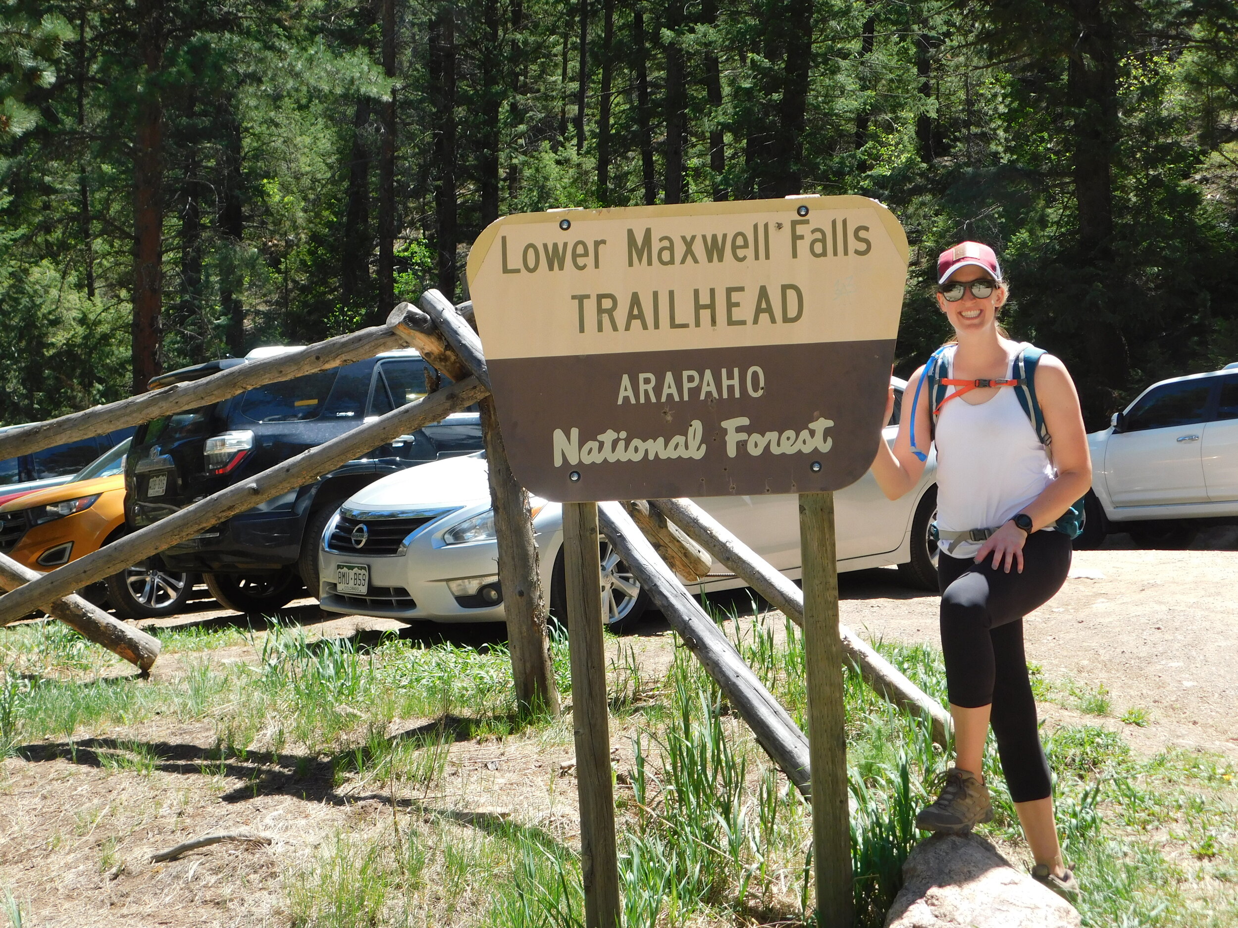
We had high hopes for this hike - it is roughly a 30 minute drive from Denver, is a loop trail, and has a waterfall. We love loop trails and really loving having some features other than it being just a hike to be hiking. If it’s an out and back trail, we love if the hike ends at a lake, waterfall, river, etc. So this being a loop and having a waterfall? Sign us up!

DSCN0322.JPG

Here’s what we think you need to know about this hike:

1. It is VERY crowded.

And we mean VERY. This hike had more people on it than we’ve ever seen on a hike. Ever. We started early, and it was already crowded with it being way more so when we were on the way out. If you want a hike that has a lot of people around, pick this. If you want a hike with very few people around, avoid this one.

2. It’s a bit of a bouldering scramble to get to the waterfall.

There is a sign that is posted that points you in the direction of the waterfall and it tells you to just follow the river up stream. What it doesn’t tell you is that you have to scramble down to scramble back up in order to get to a spot where you can see the falls.

IMG_1126.JPEG
IMG_1127.JPEG

3. Parking is free but spots in the lot are very limited.

The lot itself holds maybe 10 cars, if they all park so 10 can fit. Street parking is available but there are signs that designated no parking zones, so be careful when you street park. No one wants a towed car or a parking ticket!

4. There are three separate trails that all go to the same place.

Yes, you read that right. There are THREE trails once you get to the signs that are either for the loop, or Maxwell Falls. If you take the loop, you can pick from upper or lower. If you take Maxwell Falls, you will be running parallel and on the other side of the river than the waterfall. It does not matter which way you go. You can get to the waterfall with any of your choices.

All in, we give this hike a 3.5 out of 5. The sheer amount of people and the amount of dog poop along the trail knocked this one down for us. We are glad we did it - the hike is a great workout and the waterfall was a nice benefit, but we probably won’t be back to do this one again any time soon. Truly too many people for us.

Happy trails!

~ Liz

DSCN0291.JPG
IMG_1120.JPEG
IMG_1112.JPEG
Maxwell Falls Review.jpg

Hike Review: Legault Mountain, Conifer, CO

Disclaimer: this is an opinion about our personal experience of this hike. Others may have a different opinion, and that is perfectly acceptable. Everyone has a right to their own opinion.

If you live on the southwest side of Denver and are looking for a great hike that doesn’t take too long to drive to, this is one we would recommend!

The Legault Mountain trail is a 5 1/4 mile hike, part of which is a loop, and other parts are out and back. What we mean by that is after the first mile or so, there is a split and you can pick to go left or right - either way will get you to the same place. If you are looking to head to the summit, there is a spot at the top of the loop that branches off, and becomes an out and back.

Trailhead!

Trailhead!

Parking:

This hike has limited park lot parking, so unless you get there really early in the summer, be prepared to park on the side of the road. When we went, we had about a 1/4 mile walk to get to the trailhead from where we found parking on the side of the road. Luckily, there is a lot of road side availability!

Restrooms:

Yes, there is a restroom vault on this hike! They were closed for cleaning when we hiked by them, and we didn’t need to use them on the way down, so we don’t know what they offer as to running water or not.

The Hike:

We give this hike a 4 out of 5 stars. It has a wonderful mix of steep inclines and flat trail. When we hiked, it was rainy and the trail didn’t get slick or overly washed out. The reviews on AllTrails said the views from the top were amazing - we were unable to see much due to the rain, so we will be back to check them out in the future!

Know before you go:

  • The turn off to continue to the top of the mountain is not marked. There is a downed tree that kind of blocks off the turn, so the first time we hiked on by without realizing it was the turn off to continue up. Luckily, it’s a loop, so if you miss the turn like we did, you are heading back down to the base - you will not get lost.

  • It’s crowded. We knew it would be crowded and chose to hike it anyway - but based on the amount of vehicles parked on the side of the road on a day that was rainy and cooler, it has to be extremely crowded on nice days.

  • You will be able to hear traffic from 285 for pretty much the entire hike. While it didn’t bother us too much, if you are looking to only hear the sounds of birds chirping and the wind between the leaves, you’ll be disappointed to know that the sounds you are hearing are in fact the motorcycles out for a day drive along 285.

  • There are TONS of designated picnic spots! If you are interested in sitting at a table and enjoying lunch or a snack, there are a lot of picnic tables at the base of the hike.

All in, we liked the hike and want to return when the sun in shining so we can check out the views from the top! If you check this hike out, or already have, let us know what you think of it in the comments!

Happy Trails!
~ Team Be Outdoors

Sunny Aspen Trail is the loop that will take you up and back down - it does not matter which way you choose to go.

Sunny Aspen Trail is the loop that will take you up and back down - it does not matter which way you choose to go.

Behind this downed tree is the trail that will take you to the top. There is no sign pointing up - it’s to the left from this photo perspective - so you just have to know where it is, or use your GPS to find it.

Behind this downed tree is the trail that will take you to the top. There is no sign pointing up - it’s to the left from this photo perspective - so you just have to know where it is, or use your GPS to find it.

IMG_1016.JPEG
Legault Mountain Review.jpg

Hike Review: Catamount Loop, Woodland Park, Colorado

Disclaimer: this is an opinion about our personal experience of this hike. Others may have a different opinion, and that is perfectly acceptable. Everyone has a right to their own opinion.

The Catamount Loop, known as the “Lumber Pine, Mule Deer, Mackinaw and Ridge Trails Loop” on AllTrails is an 8 1/2 mile loop trail around a gorgeous reservoir near Woodland Park in Colorado. Here is what we think you need to know about this hike.

IMG_0870.jpg

1 - The views are STUNNING.

As you hike around the reservoir, you will have endless views of Pikes Peak, a 14,000 ft mountain in Colorado. We went counter-clockwise on the loop, so we got to stare at the mountain for 3/4 of the hike without having to turn our heads all that much. If you are more a water person, the reservoir itself offers stunning views of the blue/green water.

IMG_0858.jpg
IMG_0862.jpg
IMG_0899.jpg

2 - The hike goes in and out of actual trails and dirt roads.

The dirt roads are NOT my favorite. It was honestly very disappointing to discover that the trail becomes a road for 2ish miles, in multiple different sections of the loop. During these stretches, there is no tree cover and can get really dusty if cars use the road to get down to the reservoir.

3 - There are very steep grinds up and down.

While the elevation gain listed on AllTrails says about 1,000 feet, there are a few extremely steep ups / downs that are full of loose gravel. Hello butt-burner!!

4 - Parking is free but spots in the lot are limited.

The designated parking lot for the trailhead has maybe a dozen or so parking spots, but the good news is, parking along the road is allowed! When we got there, all spots were taken, but it was pretty easy to find a spot on the side of the road - no high clearance vehicle needed.

5 - All in, we give this 3 out of 5 stars.

Without the views this hike offered, we’d honestly rank it less, just due to the fact that the trails go in and out of dirt roads to actual trails. Out of all the hikes we’ve done, it’s hard to justify ranking this one much higher - a hike to us is a trail fully submersed in nature, not something that you have to watch out for vehicles for a significant portion of the hike. We loved the views, loved the distance, and loved the variability of challenging inclines to flat trail. We just really wish there was a trail running next to the areas of dirt road instead of merging them into one.

Additional Resources You Might Enjoy:

Day Trip Hiking Pack List

Hiking Reviews

IMG_0864.jpg
DSCN0243.JPG
Catamount Loop.jpg