hiking

Hike Review: Fish Creek Falls, Steamboat Springs, CO

We recently took a long weekend camping trip to Steamboat Springs, Colorado to celebrate my husband’s birthday. He has lived in Colorado his entire life but had never been to Steamboat so it was awesome to celebrate him while exploring somewhere he had never been before.

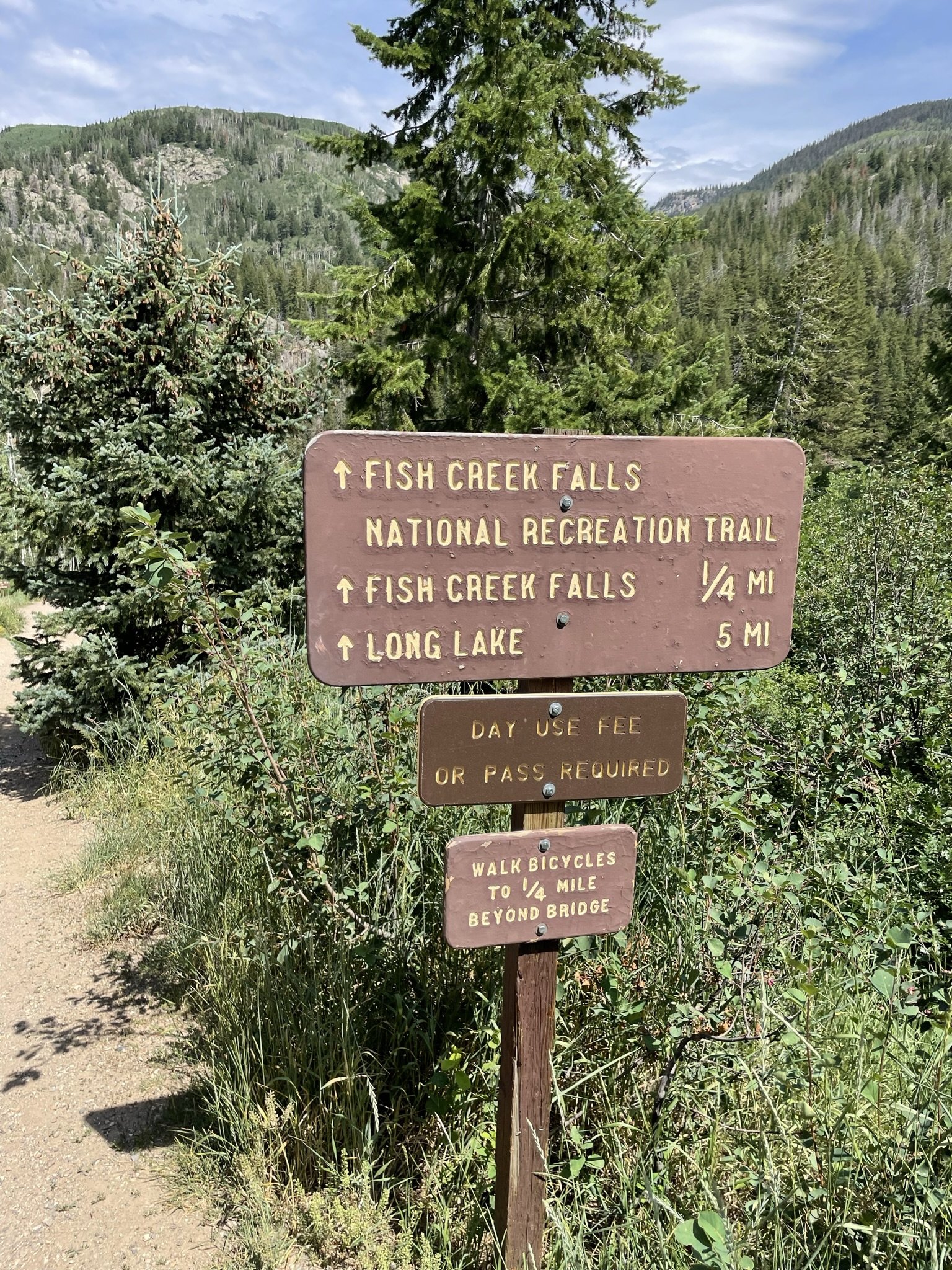
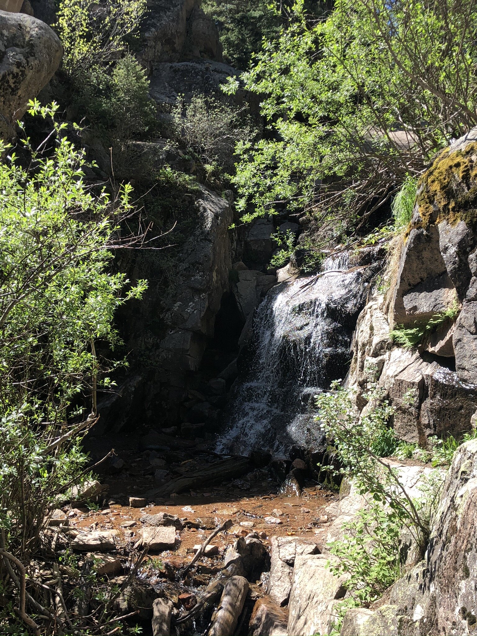
While we were camping, we decided to check out Fish Creek Falls - a well known hike and waterfall in Steamboat. There are small posted signs everywhere in town as to where the Falls are located vs where you you are standing and what direction you need to travel to get to them. Seeing all these signs made us feel like we had to check them out. And they did not disappoint!

Parking

There is a $5 fee to enter the parking lot. We were told if we had an America the Beautiful pass that the parking fee would be waved.

There are limited parking spots so on busy weekends they could fill up rather quickly.

Vault toilets were also in the parking lot, which is nice to see!

The hike

Awesome thing about this hike - there is a short hike and a long hike. Each of which are fantastic depending on what your overall desire and conditioning are.

The Short Hike - Fish Creek Falls

This hike is roughly a half-mile (0.5 mile) round trip. You start the hike going downhill and lose a lot of elevation very quickly. This is key to note as that means that your way out is going to be a pretty steep uphill hike.

You’ll know it when you get to the end of the short hike - you’ll have the most stunning view of the Falls.

The Long Hike - Long Lake

We didn’t make it all the way on the long hike. To be honest, we didn’t come prepared to go more than a few miles - I was in denim shorts and didn’t bring my hiker bag, just a small sling back that had more things in it for our doggo than it did for me. Definitely not enough water to make it on the longer hike.

But the section we did of it was beautiful and a steep grind.

You start out on the Short Hike and then proceed past the bridge and up you go, up the side of the mountain.

Apparently when you get to the top, you have an eye level view of the Falls that is supposed to be stunning. We will definitely be doing this the next time we are in Steamboat!

fish creek falls; steamboat springs; colorado; hikes; mountain hikes
waterfall; hiking; colorado waterfalls; fish creek falls; steamboat springs

Extra fun to be had

We hit the trail to the Falls on one of the hottest days of the year, so it should not have come to as big of a surprise as it did to find a ton of families at the river with their kids in swimming suits playing in the water.

The water was nice and cool - perfect for a scorching hot day in the mountains! We let Max, or doggo, play in the water for a while when we were on our way back to our car. He loved it!

fish creek falls; yellow lab; colorado mountain dog; river dog

Final thoughts

This hike is fantastic. I loved the option to do just the shorter hike to the viewing point as we didn’t come totally prepared for a longer hike. I also love that we could have continued on if we had come prepared to do so.

The fact that playing in the water was such a common thing made me smile and I know Max had the best time romping around in it.

It is an absolute must-do when you are in the Steamboat area.

fish creek falls; selfie; hiking; colorado hikes; waterfall hike; waterfall views
fish creek falls; fish creek; steamboat springs; steamboat colorado

Hike Review: Lily Pad Lake, Summit County, CO

Lily Pad Lake Trail is a fairly easy out and back trail nested at the top of Wildernest in Summit County that gives you great views of Lake Dillon and the mountain towns surrounding the lake.

Parking

There are limited designated parking spots. If you park in a non-designated parking spot, you will probably end up getting a parking ticket as the area is frequently patrolled by the Summit County Sheriff.

The Trail

The first time I did this trail, we snowshoed to the lake and back and it was amazing. But, I must say, going in summer is a totally different experience and one that I highly recommend as you learn very quickly why it is called Lily Pad Lake. In winter, the lake is frozen over and buried under feet of snow. In summer, it’s just gorgeous.

lily pad lake; colorado lakes; colorado wilderness; wildernest national forest; hiking

The hike itself can be done in about an hour and a half, but I would absolutely budget in some time to just chill at the lake. It was so calm and peaceful.

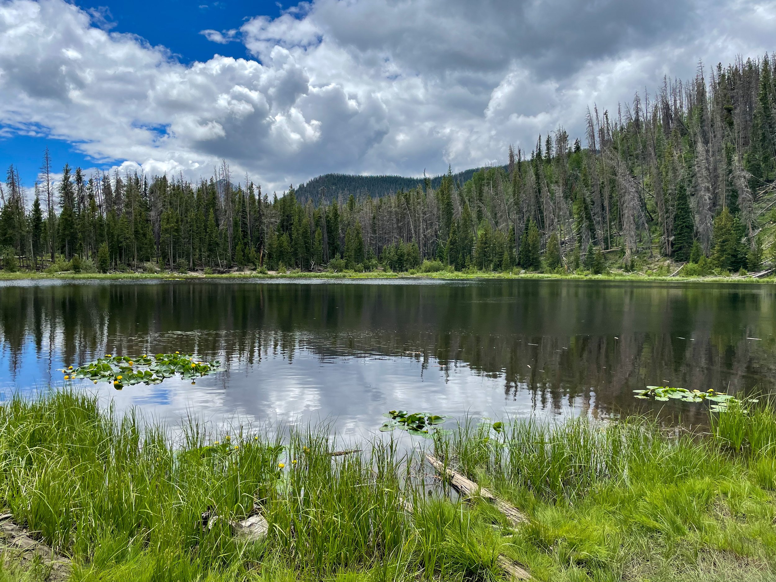
As you hike, you’re going to come across a mini lake that we thought was the Lily Pad Lake because it was absolutely covered in Lily Pads. But if you continue on, you’ll end up at the larger lake - the true Lily Pad Lake.

lily pad; lake; colorado lakes; hikes; lake hike; lake view

Smaller lake that is covered in Lily Pads! Continue on the trail to get to the actual Lily Pad lake.

Why We Loved This Hike

It’s short - only about 3 1/2 miles round trip. It’s beautiful. And dogs are allowed, on leash. We love taking Max out with us when we go hiking, but certain places do not allow dogs, so it’s an added benefit that he was able to join us.

Final Review

4 out of 5! I wish there were a few more parking spots at the trail head and that it was a tad bit longer. But it is a very solid and fun hike that ends with stunning mountain views at the lakes edge.

Eagles Nest Wildernest; National Forest; Hiking; Colorado; Summit County
trail, hiking trail, lily pad lake trail, colorado hikes, mountain views
lily pad lake; hiking; colorado hikes, hiker dog; yellow lab

A Week in Alaska: Summer Edition

This year we finally went on the trip we have been dying to go on for three years now: a week long Alaska adventure!

Steve’s best friend, Mike, and his wife live in Anchorage. Steve had been out to visit them once before, right after they moved up there. We were supposed to go in 2020, but alas, with travel being practically shut down there was no way that was going to happen.

But it finally did and it was so worth the wait! Not only were we able to spend a full week with amazing friends, we got to explore so much - from Denali to Seward to spending time at a reindeer farm, this trip lived up to the hype and more.

If you are going to go to Alaska, there are two ways to visit: go on a cruise or plan to spend some quality time in your car and book places to stay well in advance. We did the latter, though I really want to go back and do a cruise!

Alaska is freaking huge. Sorry to everyone in Texas, but your state is 1/2 as big as Alaska; or to say it the other way around, Alaska is 2x bigger than Texas. And what’s crazy - only 20% of it is accessible by road.

Take the capital for example, Juneau. If you fly into Anchorage, you cannot drive to Juneau. You have to take a plane or a ferry. We didn’t have enough time in our trip to make it to Juneau but it’s on the list for next time!

Here is what we did for our week in Alaska!

Day 1: Arrive in anchorage, drive to seward

We landed in Anchorage around 11am and were met by our friends at the airport. We quickly piled into their car and we were off on our Alaska Adventure!

It is about a 2.5 hour drive from Anchorage to Seward, but all road construction must occur in the warmer months, so definitely plan ahead for a much longer drive.

The drive is stunning, with the road running along the shoreline of the Turnagain Arm for about an hour. If you’re lucky, you’ll see a million bald eagles.

Once we got to Seward, we stretched our legs by walking along the trail of the original Iditarod and then went out to Kenai Fjord National Park to hike up to Exit Glacier.

Day 2: whale watching in seward

We pre-booked a 4 hour whale watching tour weeks before we arrived in Seward as we were afraid they would sell out. I honestly don’t know if they had any day-of tickets, but we didn’t want to take the chance.

This tour was amazing. We saw so much ocean life - orcas, sea lions, sea otters, Dall’s porpoises (Alaskan dolphins)… the list goes on.

5 out of 5 stars.

Day 3: Morning in Seward, drive to Homer

We spent the morning at the SeaLife Center, learning about sea life in Alaska. It is a rehabilitation center for injured sea life and serves as a public aquarium. I absolutely loved being able to see Puffins up close!

We hit up a local coffee shop and found some great Alaska branded merchandise at the Alaska Shop.

Then we hit the road for a 3ish hour drive to the Homer Spit.

Once there, we walked the Spit to check out dining options and the cute local shops. We only stayed here one night but it was well worth the drive. The scenery was unreal!

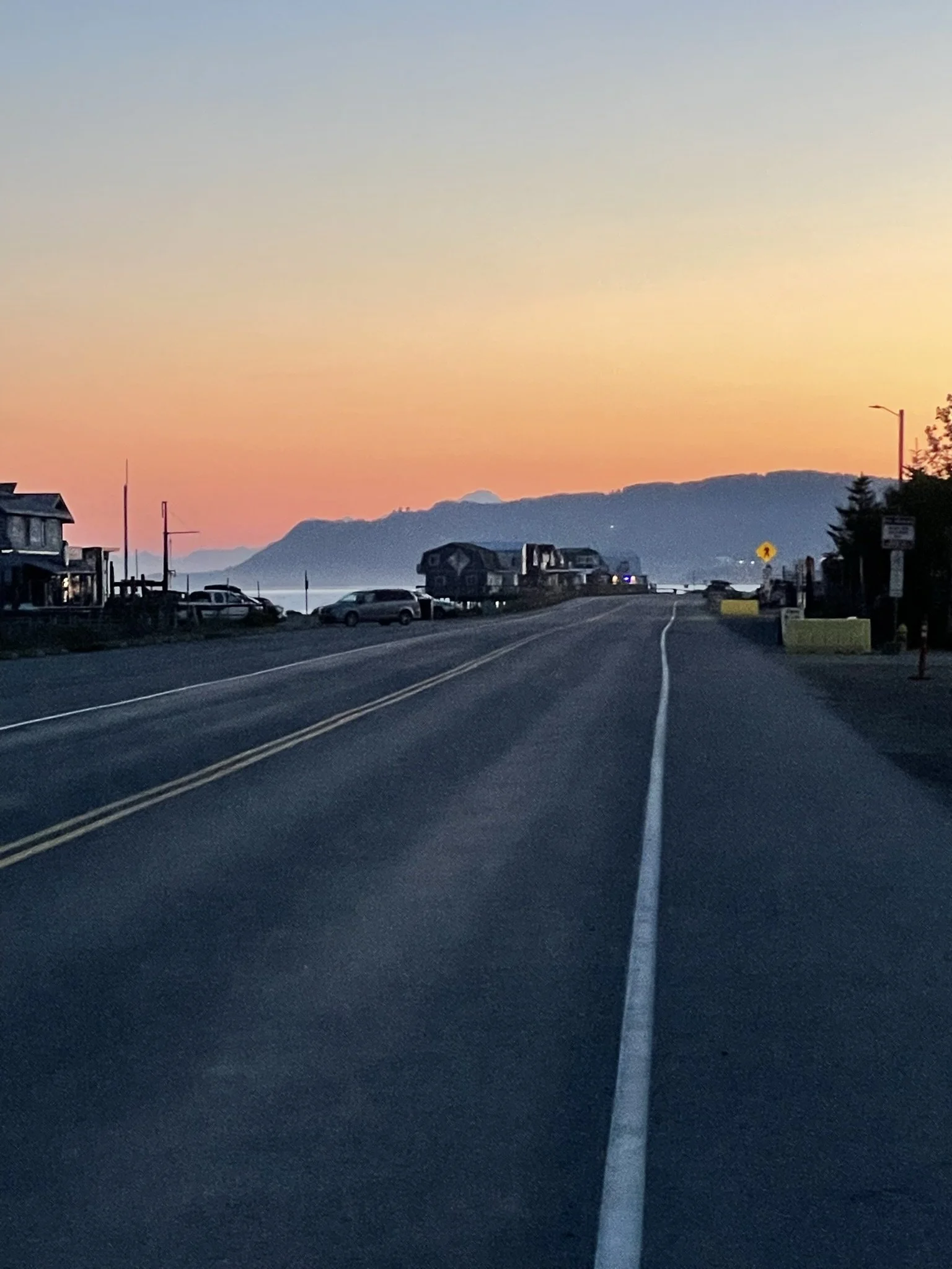
Homer Spit, Sunset

Day 4, 5, & 6: Anchorage as our base

We were recommended an awesome diner in Homer for breakfast before we hit the road back to Anchorage so we did that for breakfast. The drive to Anchorage is just over 4 hours, and we planned to stop at a brewery on the way back in Cooper Landing.

Once we got back to Anchorage, it was dinner time. We had to go to Moose’s Tooth, a local favorite, for pizza and more beer. So delicious. Its for sure on our list every time we visit!

The following day we decided to hike a glacier, the Matanuska Glacier, just northeast of Anchorage. We signed up for a guided tour and off we went. It was AMAZING. Hands down one of the coolest experiences I have ever done.

Day 6 was spent going to Whittier, this super bizarre town. You have to drive through a one-lane tunnel to get there and back.

Whittier is this small town that has most of its residents living in one condo complex. It exists because it is a major port town for goods to come in to Alaska. The train shares the one-lane tunnel with vehicles - thank goodness for modern technology letting everyone know which direction has right of passage and if the train is needing the tunnel!

I would absolutely go back to Whittier for the views alone. The sheer amount of waterfalls you can see is unlike anything else!

On the way back from Whittier, we detoured into Girdwood to hike the Virgin Falls Trail and visit the Girdwood brewery. 10/10 recommend doing both activities!

Day 7, 8 & 9: Denali National Park

We headed up to Denali on day 7 to stay 2 nights and then head back to Anchorage on day 9 to catch our red-eye flight home.

On our way up to Denali, we took a pitstop to visit Williams Reindeer Farm. We got to feed real life reindeer! A super cool experience that I’d absolutely go again.

The drive to Denali is long. But if Denali is out, meaning the sky is clear and you can see Denali, it is one of the most stunning drives you will ever have. The drive was totally worth it for us as Denali was indeed out for us to gawk at!

Day 8 was spent hiking and exploring Denali National Park. We ventured about 20 more minutes passed the Park entrance to visit 49th State Brewing for a late dinner and beer. They have a replica bus of the one that was made famous in Into the Wild that you can check out, awesome outdoor fire pits, and great beer and food.

Day 9 was our last day. We had a red-eye flight back to Colorado so we hit the road to head back to Anchorage, said “see you soon!” to our friends.

Reindeer Farm!

49th State Brewery - Into the Wild replica bus

I wouldn’t trade a single thing about our trip for something else. It was everything we were thinking it would be and more.

At some point I would love to do a cruise as you get to see so much of Alaska that you otherwise wouldn’t be able to see since it’s not on the road system. And we absolutely want to go back in winter to ski for a few days then head to Fairbanks to hopefully be able to catch the Northern Lights.

Happy Adventures!

Alaska; summer trip; adventure; outdoors

Beginners Guide: 3 Tips to Get Started Snowshoeing

Please note, this post contains affiliate links. See our Disclosures Page for more info.

Winter is here and we LOVE it. It’s one of our favorite times to be outside. Yes, it’s colder. Yes, it gets darker faster. Yes, you have to wear a ton of layers. But there are so many fun activities you can do in winter that you can’t do any time of year. One of our favorite ones is snowshoeing! If you love to hike and are looking for a way to do so in winter, snowshoeing is the way to go for you! Read on for our top 3 tips to get you started snowshoeing!

IMG_9587.JPEG

1. what do you wear?

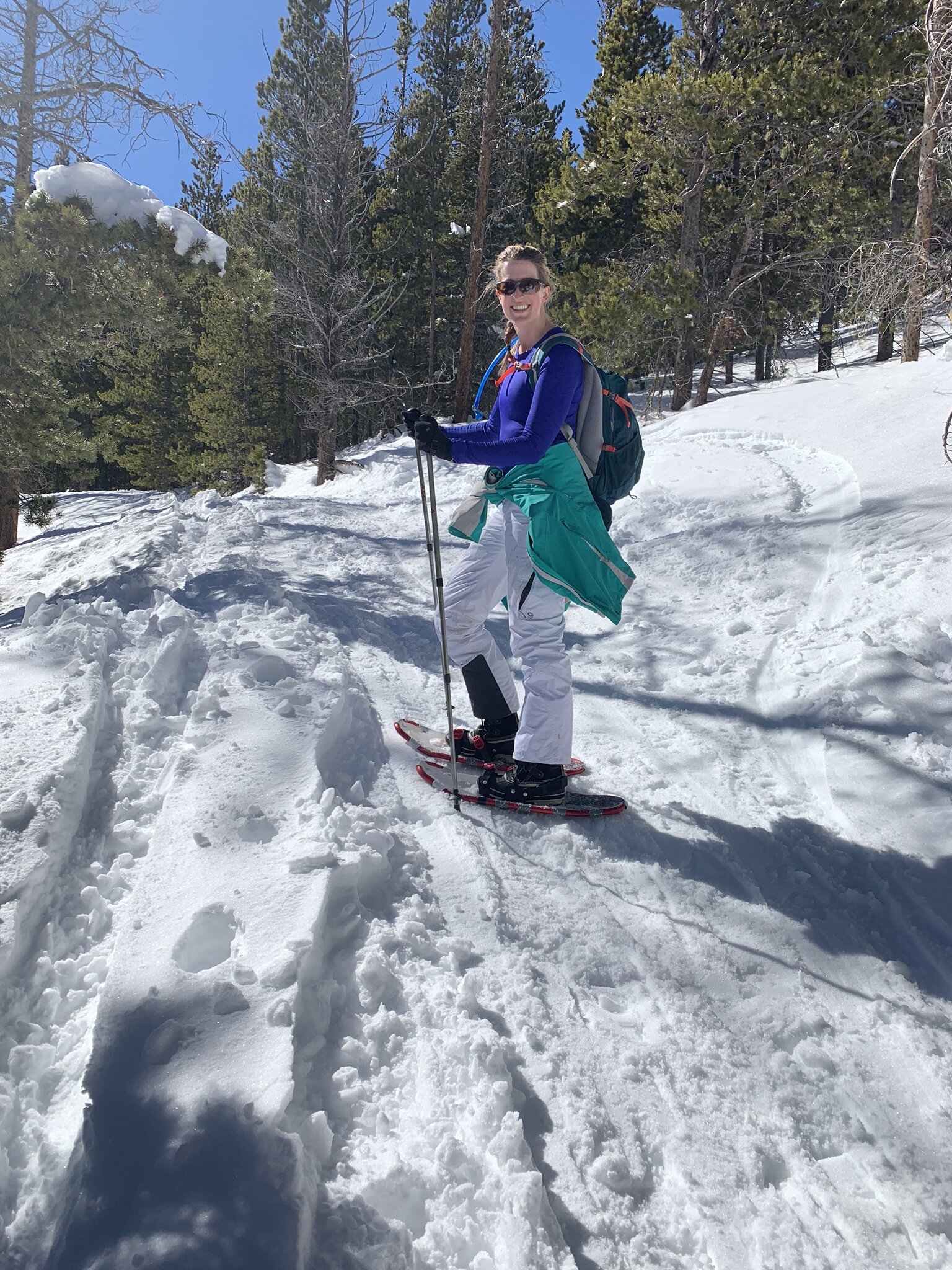
This is the #1 question we get and it’s a great question. It can seem daunting to figure out how to stay warm and keep your feet dry. Our biggest tip - wear layers. You can always take some off if you get too warm (and yes, you can definitely get too warm even when it’s 20 degrees outside!).

I recommend wearing a warm base layer - running/active leggings and a tight fitting cold-gear top. Purchase some wool socks (we love the Smartwool brand) so your feet stay as warm as possible.

For your outer layer, if it is forecasted to be really cold or has snowed a ton the last few days, we wear snowpants over our leggings. On the top, we wear a coat that is built for cold activities, either a ski coat or a down coat. I personally love the Eddie Bauer light weight down coats - they have some that are rated to -20 degrees that are perfect for snowshoeing! If it hasn’t snowed or isn’t going to be too cold, I just go with leggings, no snowpants, and Steve goes for hiking pants. We still tend to wear a warmer coat.

Waterproof Boots. Besides having good layers, wearing waterproof boots is a MUST. Frozen toes are never fun. Wet, frozen toes are even worse. So find yourself some waterproof sturdy boots. I either wear Sorel snowboots that come up to about mid-calf, or I wear waterproof Merrel hiking boots that are made for winter (aka, they are lined on the inside to keep your feet extra toasty).

Sunglasses or ski goggles. If it’s sunny outside, you are going to want sunglasses. The sun reflecting on the snow makes for an extra bright day! We also will sub our sunglasses our for ski goggles. These wrap around our eyes more and block the glare off the snow in our peripheral vision which is really nice on a extra sunny day. If you want a cheaper pair of sunglasses to wear while being active outdoors that are polarized and don’t slip when you sweat, check these out.

A winter hat or ear warmers. There is not much worse than cold ears! Don’t forget to wear a hat or ear warmers to keep them warm. I know if I forget one, I’m signing myself up for a major ear ache the rest of the day.

Gloves. Keep those hands warm! If it’s going to be extra cold, it never hurts to throw some handwarmers in your gloves too.

IMG_0375.JPEG

2. where do you get snowshoes? and what kind should i get?

You can purchase snowshoes at pretty much any outdoor gear store - REI, Christy Sports, Cabella’s, etc. You can also purchase them at Costco right around the holiday season, but once they are out, they don’t seem to get more shipments.

Brand wise, there are a few out there that are well known, and they have ranges of prices for their equipment. Tubbs, MSR, and Crescent all have great reviews and good ranges of prices for what you are looking for.

We purchased our first ones, beginner level, cheaper snowshoes on Amazon for ~$60 a pair, and honestly, they were an “off brand”. But they worked great for what we were wanting - a pair of snowshoes that we could learn with and not worry too much of beating them up or doing something wrong. Plus, we thought we would love snowshoeing, but if it had turned out we actually didn’t, we wouldn’t have been out a ton of money on gear. We have since purchased better ones from REI and are hoping they last us a long time since they were pricy!

If you are not sure you want to invest in your own snowshoes yet, you can rent them from REI! We love this as it will allow for you to give snowshoeing a try without too much investment.

3. how do i find a trail to snowshoe?

This is also a great question and we have learned the hard way that a “moderate” trail in summer is a LOT harder in snowshoes! Besides what to wear and what gear to get, this is the biggest thing to research so you can have the best experience.

We use the app AllTrails to find all our trails. To snowshoe, we recommend looking for a trail that is rated as “easy” - remember that snowshoeing is more difficult that standard hiking - with a distance in the 3-5 mile range.

Read the reviews on the app. A lot of users will put the conditions of the trail in their reviews and how they went about it. If there are no recent reviews, maybe add it to a list to look at again later if you like the look of it, and keep searching until you find one with more recent reviews so you know what to expect.

We hope you have a blast on the trails! If you have any specific questions, shoot us an email through our contact page, or leave it in the comments below!

Happy adventures!

Liz

07562836-3061-4CD9-8731-12093113D61D-2.jpg
IMG_9672.JPEG
Beginners Guide to Snowshoeing.png
IMG_4611.jpg

Hike Review: Cheesman Canyon, Sedalia, CO

Cheesman Canyon is one of those hikes that has been on our list but not a high priority to do, thinking it wouldn’t be anything overly amazing. Well, we finally can cross this one off and, wow were we wrong! This hike has so much about it that we loved. In fact, the only thing we would say is a downfall is that there is very little shade. But, we did pick one of the hottest weekends of the summer to do this hike, so really that is our own fault, as this hike would be absolutely perfect on a warm but not blazing hot day.

Keep reading for our full review as to why we loved it!

IMG_1753.JPEG
IMG_1761.JPEG
  1. The hike is along a river!

    Yes, you literally hike along the river for the majority of the hike! There are a ton of fishermen around and a lot of access points from the upper trail to the water. So if you get too hot, you can work your way down to the water to cool off.

  2. Good ups and downs the whole way.

    We love a good hike that is pretty equal effort both ways. This is not a hike that is up one way and down the way back. You get the challenges of inclines and declines both ways. This means that you don’t have a ton of overall elevation gain (you never get above treeline) but you get the workout associated with a strong elevation gain!

  3. If you go far enough, you hit a reservoir.

    We did not make it far enough in on this hike to hit the reservoir (hello, 100 degrees by 10am!) but if we were to have kept going, there would have been a reservoir for us to sit by and enjoy. The reservoir feeds the river that you hike along. Needless to say, we will be back to get to the reservoir on a cooler day!

  4. Not overly busy.

    We arrived at the parking lot by about 8am and had no issues parking. However, when we were leaving there were cars circling the lot waiting for a space. There is no street parking - if you park on the street you will get ticketed if caught.

We will warn you that the trail is mostly loose gravel - meaning that the declines are slippery and your feet can definitely come out from underneath you if you aren’t overly cautious. Yes, speaking from experience on that one. Whoops! Luckily I only scraped my hand a little bit, but it could have been much worse!

Overall, we give this hike a 4 out of 5 stars.

Happy Trails!
Liz

IMG_1751.JPEG
IMG_1768.JPEG
IMG_1788.JPEG
IMG_1802.JPEG
Hike Review Cheesman Canyon.jpg

Hike Review: Tyndall Glacier and Nymph, Dream, Emerald, and Haiyaha Lakes, Rocky Mountain National Park, CO

Disclaimer: this is an opinion about our personal experience of this hike. Others may have a different opinion, and that is perfectly acceptable. Everyone has a right to their own opinion.

This particular hike we come back to time and again because of how beautiful the scenery is. Located in Rocky Mountain National Park, this hike features so many amazing things, you can’t help but just be in awe the entire hike. 4 lakes. A couple waterfalls. A glacier. It’s one of our all time favorites and we hope you enjoy it as well if you choose to hike it!

IMG_1343.jpg

Getting into RMNP

This year, you must reserve a time slot entry to get into RMNP, as well as have a pass to get into the park for the day. The pass can be a season pass, a day pass, the American the Beautiful Pass, etc. This has changed from prior years due to the Covid-19 outbreak. They do not offer these time slot entries at the gate so you much reserve them online in advance. To do that, you can CLICK HERE or log into recreation.gov, search for Rocky Mountain National Park, pick a date that has available time slots and pick your time! Once you pick your time, you have two hours to enter the park, so if you purchase the 8am entry, you have from 8am - 10am to enter the park. Once you are in the park, you can stay as long as you want. Be sure to take a screenshot of your confirmation on your phone, or print it out, as you will have to show it at the gate.

IMG_1202.jpg

Where to park

Parking is all over the park once you get in, but watch for the road signs on what is full. If you can, we recommend parking at Bear Lake Lot - it’s the closest parking lot to the trail head. We say “if you can” because this lot fills up FAST. If it’s full, we recommend the park-and-ride lot. It’s easiest to find parking and you will have quick access to a shuttle bus that will take you up to Bear Lake and will have access to the same shuttles to take you back to your car when you are ready to head out.

The Elevation

This hike is a 5.1 mile out and back hike that has an elevation gain of ~1,100 feet. Keep in mind that you are starting at a very high elevation already at 9,449 ft above sea level. Entering the park, you will be at 7,860, and you will gain substantial elevation driving up to Bear Lake. Bring more water than you think you’ll need, snacks, and something with salt - your body might need it.

If you are coming from out of state, be sure to read about elevation sickness and the warning signs - it’s a very real thing and it’s not fun if you have it.

The Hike Itself

This hike is STUNNING. There are four lakes - five if you count Bear Lake - and they are so gorgeous. Our favorite one… it’s hard to pick! But if I had to, the lake at the base of the glacier is unreal and totally makes the hike. Be sure to look into the water as you walk by as you can some time see some fish swimming along.

DSCN0336.JPG

We went in mid-June and there were still patches of snow on the hike. We did not have to use any gear other than our hiking boots, and saw some people in regular tennis shoes cross through the snow patches with no issues.

Rocky Mountain National Park is stunning and this hike showcases it to the nth degree. We absolutely love it and tend to hike this at least once a year. We give this hike a rare 5 out of 5 stars. Let us know what you think when you hike this as well!

Additional Resources You Might Enjoy:

Hike Review: Eagle’s View Trail

Day Trip Hiking Pack List

DSCN0354.JPG
DSCN0379.JPG
IMG_1390.JPEG
IMG_1431.JPEG
Hike Review_ Tyndall Glacier, Nymph, Dream, Emerald Lakes.jpg

Hike Review: Eagle's View Trail Loop, Conifer, CO

Disclaimer: this is an opinion about our personal experience of this hike. Others may have a different opinion, and that is perfectly acceptable. Everyone has a right to their own opinion.

We’ve absolutely been loving the Conifer hikes lately. There is something to be said about finding hikes that are only 30ish minutes away from Denver! This hike is just south of Conifer in Reynolds Park. Considering how close this hike is to Denver, we headed out early to try to beat the crowds - and we are very happy we did! Here’s what we think you need to know about this hike!

IMG_1264.JPEG

Parking is free and the lot is actually decently sized.

We were pleasantly surprised to see a decent sized lot at the trail head that easily could fit 20 cars (or more) without having to park parallel or on the street! We arrived around 8:15 and had no issue finding a parking spot.

There are restrooms at the trail head.

Woohoo! This is always a great surprise when we see this. As comfortable as we are peeing in the woods, it’s always nice to not actually have to since a restroom is available!

The view makes this hike worth it.

The hike itself is a 4.2 mile loop trail which doesn’t sound too long, but considering the elevation gain you have during the first mile of the hike, we were glad it was on the shorter side. We went counter-clockwise and got a killer booty/hamstring/calf muscle workout in! Coming off the steep and steady incline and seeing the valley and mountain ridges for miles and miles and miles.. yeah, those views are why you do this hike.

IMG_1251.JPEG

Dogs are allowed on leash.

Unlike the Maxwell Falls hike we did, we did not see any dog poop on the trail! Thank you responsible dog owners!! This hike is STEEP and a good portion of it is not shaded, so if you bring the pups, be sure to bring them their own water. You do not want to be that dog owner that has to call the park rangers for assistance on getting their dog carried out after the doggo overheated. Yes, that happens.

We rate this hike 4.5/5 stars!

We loved the challenging incline on this hike, especially with the shorter distance this hike is. With the early start, we didn’t see more than 10 people on the trail until we were almost back to the parking lot. Having restrooms, a nice sided parking lot, and it being only a 30ish minute drive from where we live definitely adds stars to this hike for us.

If you hit this trial, let us know what you think by leaving a comment or sending us an email! We love hearing about everyone’s experiences!

Happy Trails!
~ Liz

IMG_1236.JPEG
IMG_1229.JPEG
IMG_1204.JPEG
IMG_1228.JPEG
Hike Review_ Eagles View Trail.jpg

A Weekend Guide to Camping in Aspen

Camping season is here and we are so excited!! We love camping for many reasons, but one of the best is that you can go to so many places and have a place to stay for pretty cheap. If you are one to reserve campsites, you can get one for around $20/night, and if you are one that likes to gamble on if they can find a first-come-first-serve spot, you can get one for pretty much free. You really cant’t beat free-$20/night going to Aspen for the weekend!

Here are our recommendations for a weekend camping in Aspen!

IMG_7067.JPEG

Day 1

Arrive into downtown Aspen in time for a late lunch. Pick a local cafe or restaurant to have a nice lunch after a long drive. We parked and walked around downtown and stumbled across this amazing deli called Butcher’s Block (see their website here!) which offers made to order sandwiches. The meat is fresh shaved and just absolutely delish!

After lunch, head out to your campsite and get set up. We booked a spot at Difficult Campground which is about 5 miles outside of Aspen! If you reserve a spot, you typically can arrive to the site at 2pm. Be sure to stop and check in with the site host and purchase a bundle of firewood for your fire pit.

Have dinner at the campsite and treat yourself to a s’more!

Stay up late and stargaze. The stars and moon are SO bright in this area of Colorado!

IMG_7063.JPEG
IMG_7064.JPEG
IMG_7267.JPEG

Day 2

Get up, make a hearty breakfast burrito filled with eggs, bacon, and potatoes. Pack your hiking bag - don’t forget your rain coat - and head to the Four Mountain Sports shop in Aspen Highlands to purchase your shuttle ticket to Maroon Bells. (Please check this site for updates on reservations due to COVID-19)..

Unless you are a super-duper early bird, or an avid bike rider, taking a shuttle from Aspen Highlands is required in order to get to Maroon Bells.

Spend the day hiking around the park. Take amazing photos. Get caught in the rain. Marvel at the scenery. Catch one of the last shuttles out of the park back to the parking lot you left your car in.

Head to downtown Aspen to Aspen Brewing Company (if you are over 21) for a local craft beer or to CP Burger for ice cream and a round of mini golf.

Eat dinner at the campsite. Have another s’more because you hiked all day and deserve it. Try to stay up to stargaze again.

E75EBB09-AE71-4489-8391-49AED6F358BE.jpg
IMG_7127.JPEG
IMG_7158.JPEG

Day 3

Get up early, eat eggs and bacon for breakfast, pack your hiking bag again, pack up camp making sure to leave no trace, and head into downtown Aspen to take the gondola up to the top of the mountain.

You can purchase tickets at the ticket window which is before you walk up the two flights of stairs to the gondola. Don’t miss the sign otherwise you will be walking back down only to have to walk back up those stairs once your ticket is purchased.

Wait for a red gondola - you can connect your phone and play music on your ride up!

Follow the trails at the top of the gondola for a hike with stunning views. Grab a beer at Sundeck and enjoy the live music that is almost always there before taking the gondola back to the bottom - unless you are the more adventurous kind and hike to the bottom.

Check out the cute local shops and pick up a souvenir from your weekend get away.

Head back to your car and head home - it’s been a great outdoors weekend!

Additional Resources You Might Enjoy:

Day Trip Hiking Pack List

ED180E88-71A1-4B04-BDD9-29C99D96403D.jpg
IMG_7273.JPEG
IMG_7287.JPEG
IMG_7291.JPEG
Weekend Guide to Camping in Aspen.jpg

Hike Review: Maxwell Falls Trail, Conifer, CO

Disclaimer: this is an opinion about our personal experience of this hike. Others may have a different opinion, and that is perfectly acceptable. Everyone has a right to their own opinion.

We had high hopes for this hike - it is roughly a 30 minute drive from Denver, is a loop trail, and has a waterfall. We love loop trails and really loving having some features other than it being just a hike to be hiking. If it’s an out and back trail, we love if the hike ends at a lake, waterfall, river, etc. So this being a loop and having a waterfall? Sign us up!

DSCN0322.JPG

Here’s what we think you need to know about this hike:

1. It is VERY crowded.

And we mean VERY. This hike had more people on it than we’ve ever seen on a hike. Ever. We started early, and it was already crowded with it being way more so when we were on the way out. If you want a hike that has a lot of people around, pick this. If you want a hike with very few people around, avoid this one.

2. It’s a bit of a bouldering scramble to get to the waterfall.

There is a sign that is posted that points you in the direction of the waterfall and it tells you to just follow the river up stream. What it doesn’t tell you is that you have to scramble down to scramble back up in order to get to a spot where you can see the falls.

IMG_1126.JPEG
IMG_1127.JPEG

3. Parking is free but spots in the lot are very limited.

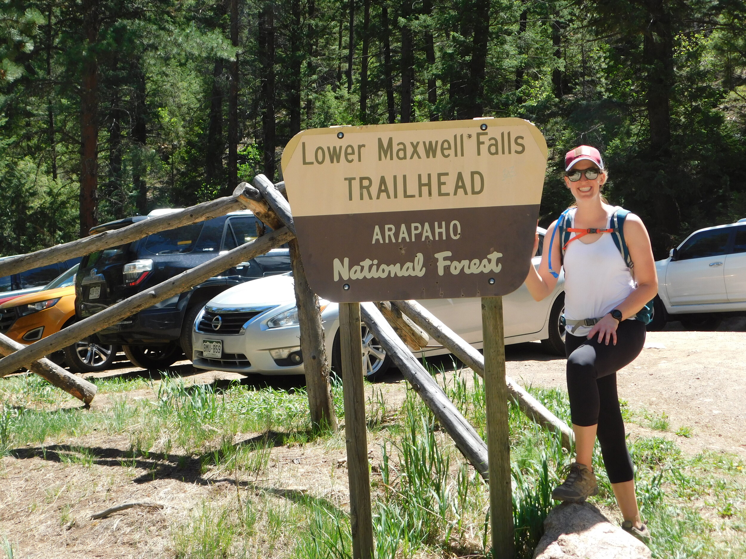
The lot itself holds maybe 10 cars, if they all park so 10 can fit. Street parking is available but there are signs that designated no parking zones, so be careful when you street park. No one wants a towed car or a parking ticket!

4. There are three separate trails that all go to the same place.

Yes, you read that right. There are THREE trails once you get to the signs that are either for the loop, or Maxwell Falls. If you take the loop, you can pick from upper or lower. If you take Maxwell Falls, you will be running parallel and on the other side of the river than the waterfall. It does not matter which way you go. You can get to the waterfall with any of your choices.

All in, we give this hike a 3.5 out of 5. The sheer amount of people and the amount of dog poop along the trail knocked this one down for us. We are glad we did it - the hike is a great workout and the waterfall was a nice benefit, but we probably won’t be back to do this one again any time soon. Truly too many people for us.

Happy trails!

~ Liz

DSCN0291.JPG
IMG_1120.JPEG
IMG_1112.JPEG
Maxwell Falls Review.jpg

Hike Review: Legault Mountain, Conifer, CO

Disclaimer: this is an opinion about our personal experience of this hike. Others may have a different opinion, and that is perfectly acceptable. Everyone has a right to their own opinion.

If you live on the southwest side of Denver and are looking for a great hike that doesn’t take too long to drive to, this is one we would recommend!

The Legault Mountain trail is a 5 1/4 mile hike, part of which is a loop, and other parts are out and back. What we mean by that is after the first mile or so, there is a split and you can pick to go left or right - either way will get you to the same place. If you are looking to head to the summit, there is a spot at the top of the loop that branches off, and becomes an out and back.

Trailhead!

Trailhead!

Parking:

This hike has limited park lot parking, so unless you get there really early in the summer, be prepared to park on the side of the road. When we went, we had about a 1/4 mile walk to get to the trailhead from where we found parking on the side of the road. Luckily, there is a lot of road side availability!

Restrooms:

Yes, there is a restroom vault on this hike! They were closed for cleaning when we hiked by them, and we didn’t need to use them on the way down, so we don’t know what they offer as to running water or not.

The Hike:

We give this hike a 4 out of 5 stars. It has a wonderful mix of steep inclines and flat trail. When we hiked, it was rainy and the trail didn’t get slick or overly washed out. The reviews on AllTrails said the views from the top were amazing - we were unable to see much due to the rain, so we will be back to check them out in the future!

Know before you go:

  • The turn off to continue to the top of the mountain is not marked. There is a downed tree that kind of blocks off the turn, so the first time we hiked on by without realizing it was the turn off to continue up. Luckily, it’s a loop, so if you miss the turn like we did, you are heading back down to the base - you will not get lost.

  • It’s crowded. We knew it would be crowded and chose to hike it anyway - but based on the amount of vehicles parked on the side of the road on a day that was rainy and cooler, it has to be extremely crowded on nice days.

  • You will be able to hear traffic from 285 for pretty much the entire hike. While it didn’t bother us too much, if you are looking to only hear the sounds of birds chirping and the wind between the leaves, you’ll be disappointed to know that the sounds you are hearing are in fact the motorcycles out for a day drive along 285.

  • There are TONS of designated picnic spots! If you are interested in sitting at a table and enjoying lunch or a snack, there are a lot of picnic tables at the base of the hike.

All in, we liked the hike and want to return when the sun in shining so we can check out the views from the top! If you check this hike out, or already have, let us know what you think of it in the comments!

Happy Trails!
~ Team Be Outdoors

Sunny Aspen Trail is the loop that will take you up and back down - it does not matter which way you choose to go.

Sunny Aspen Trail is the loop that will take you up and back down - it does not matter which way you choose to go.

Behind this downed tree is the trail that will take you to the top. There is no sign pointing up - it’s to the left from this photo perspective - so you just have to know where it is, or use your GPS to find it.

Behind this downed tree is the trail that will take you to the top. There is no sign pointing up - it’s to the left from this photo perspective - so you just have to know where it is, or use your GPS to find it.

IMG_1016.JPEG
Legault Mountain Review.jpg